

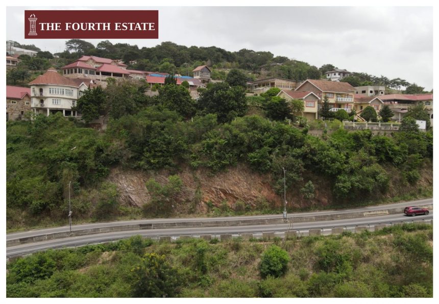
On the edge of a cliff along the Aburi Hills where Accra’s urban sprawl seems relentless, a semi-finished mansion sits precariously, overlooking the endless convoy of commercial and private vehicles that whiz below it.
On its fence wall, a mason splatters mortar and, with his trowel, smoothens the fence of the giant edifice.
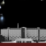
The aerial photographs, transmitted by The Fourth Estates’ drone hovering above the mason and his fellow workers, show a grand edifice that looks more like a resort than a residential facility.
But whether it is a resort or private residential facility, it is in the good company of many gigantic buildings that are threatening to outshine the iconic presidential retreat centre located in the area—the Peduase Lodge—which used to enjoy an absolute monopoly of palatial grandeur on that part of the Akuapem range.
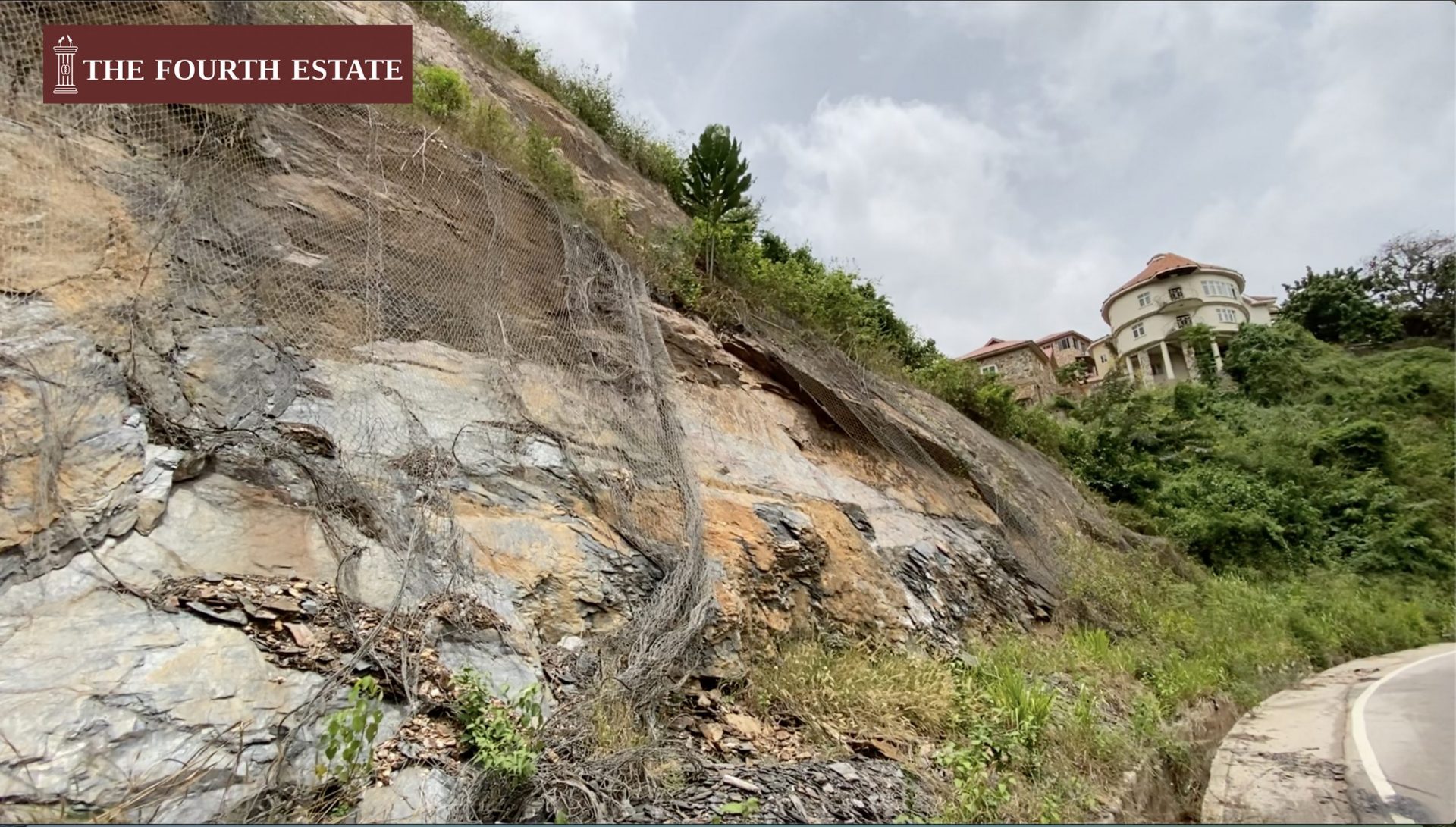
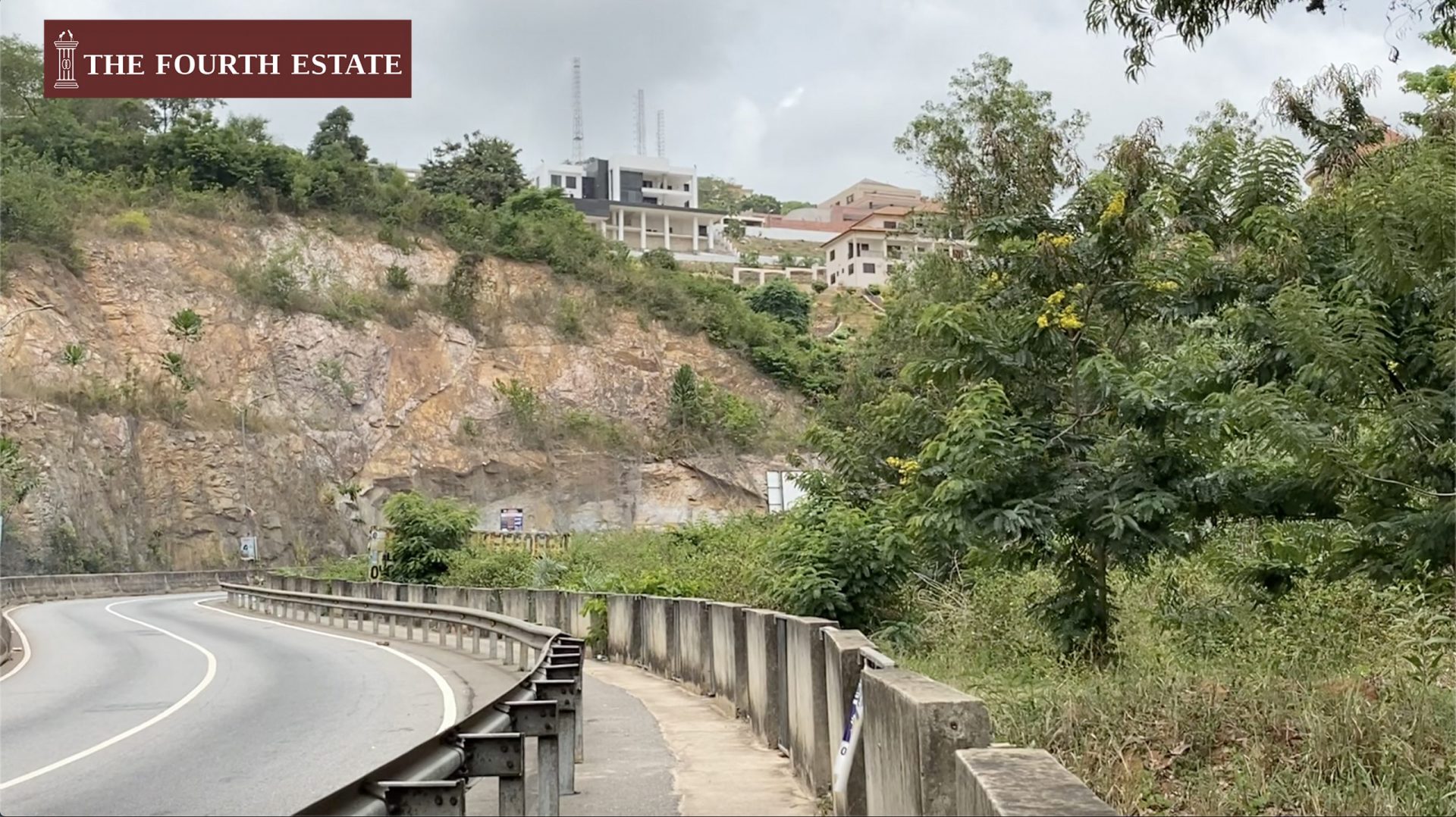
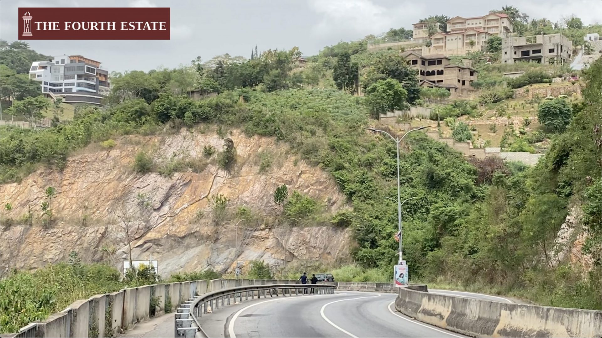
This building in question is one of the many buildings sprouting along the Accra-Aburi highway. The road meanders along this section of the Akuapem range like a giant snake. The highway lies beneath most of the houses because the contractors working on the road had to cut through the edge of the hills to build the road.

If the mason dropped a tennis ball outside the fence wall of the building, the probability that it would find its way onto the Aburi-Accra section of the dual-carriage highway would be ten out of ten.
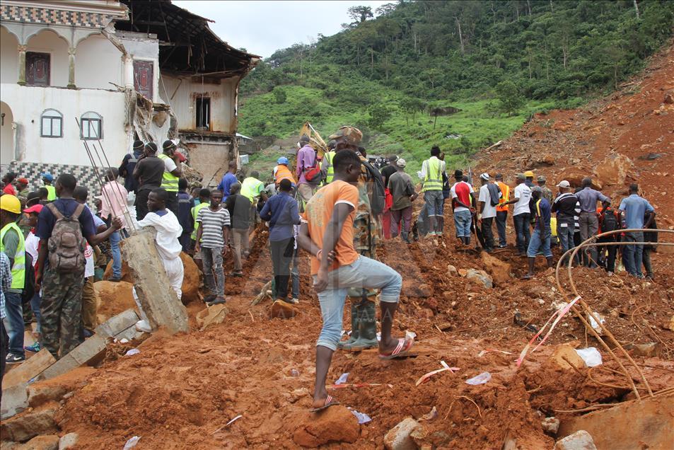
The boulders between the houses above and the road below are held from falling by giant metallic mesh, a project that cost the nation 11 million cedis to undertake when, in 2016, the falling rocks posed an immense danger to motorists on the Aburi-Accra section, forcing authorities to close the road for about a year.
The house the mason and his fellow workers were finishing when the news crew of The Fourth Estate visited the area in March 2021, as well as other such buildings along the edge of the Aburi Hills, were among the main reason authorities gave for the falling boulders.
The scores of houses and hotels scattered up the hills and the cliffs along the road are the glamorous investment of some of Ghana’s wealthy folks on the serene Aburi Hills. But beneath the veneer of affluence is chaotic and unbridled destruction of the vegetation.

From afar, the dangers are not visible, but a closer look shows hair-raising environmental degradation, an obscene desecration of the verdant vegetation, which portends greater danger than what has been experienced in the past, according to experts.
After the contractors cut through the mountainous stretch during the reconstruction of the road about 14 years ago, the boulders acted as a retaining wall.
But, today, just like the buildings, the boulders perch precariously on one another, ready to fall at the least disturbance, onto the Accra-bound section of the road.
Along the stretch, some of the rocks are seen falling onto the road despite attempts by contractors to restrain them with the giant mesh.
While the buildings might be contributing to reducing Ghana’s burgeoning housing deficit—more than two million— the loss of vegetation comes with enormous cost to those living beneath the hills.
Earthquake warnings
The Head of the Geological Survey Authority’s Earthquake Monitoring and Geo-Hazards Division, Nicholas Opoku, agrees that there are gloomy days ahead for buildings on the sloping side of the Aburi Mountains.
For years, the Ghana Geological Survey Authority (GGSA) has been warning that the series of earth tremors in parts of the Greater Accra Region signal a possible earthquake of greater magnitude in the future.
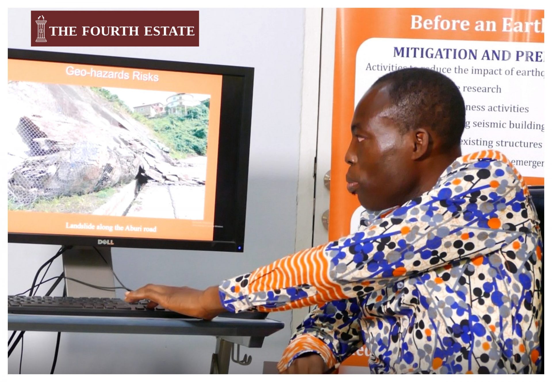
Its principal seismologist, Nicholas Opoku, who has studied the situation on the Aburi Mountains, warns that its sloping parts are a dangerous place to build. According to him, it connects to the epicentre of Ghana’s earthquakes, which runs from Gomoa Fetteh in the Central Region, through McCarthy Hill in Accra toward the Akuapim range, all the way to Ho in the Volta Region.
“That stretch of the mountain [Aburi] is actually a fault zone, meaning it is a potential source of earthquakes. But these earthquakes are much more prominent along the coastal areas, that is [Gomoa] Nyanyano where the mountains meet the coastal boundary fault. It is the reason we have a lot of earthquakes around the Weija area.”
But there is more to the littering of buildings on the Aburi Hills than the dangers of earthquakes.
Threat to life down the Aburi Hills
Charles Kwadam, a resident of Oyarifa UT Estate down the Aburi Hills, says those of them who live in the area have been at the receiving end of the vagaries of the depleted hills, especially during the rainy season.
Mr. Kwadam relocated to the countryside due to what he terms “excessive noise” in the part of Accra where he used to live.
But the peace of mind he craved now remains a remote dream as brick and mortar continue to increase on the sloping mountain with the developers stripping the mountain of its dense, green vegetation.
With the mountain barely able to hold torrents of rain as the buildings on the highland increased, erosion has created deep gullies, pushing down the debris of floodwater and soil into the walled estate through the entrance, which faces the hills.
Mr. Kwadam observes that the degradation has been so inimical to the residents that it has become necessary to reengineer their homes by raising concrete slabs, fixing new tiles, and creating waterways to escape the wrath of water whenever it rains.
“Trees which hitherto served as water blocks and prevented soil erosion have been chopped down for construction purposes,” he says, pointing to a thick cloud of smoke from a nearby clearing on the hill.
“All the water that collects on the mountain now comes down to the estate because there are no drains to collect the water from there,” he tells The Fourth Estate.
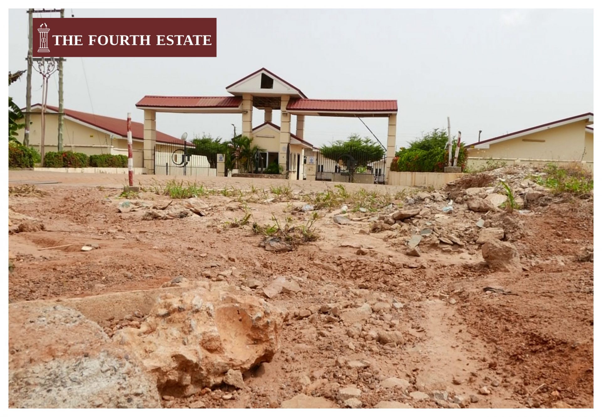
With the flood pounding the entrance of the estate, half of it has been beaten into a gully, making it almost impossible to drive into the community.
Mr. Kwadam says although their plight has been reported to the authorities, “nothing useful has ever come out from our complaints.”
“This house located at the junction here lost its beam due to the amount of water it has to contend with every time it rains,” Mr. Kwadam says of a house outside the entrance of UT Estates. It bears the unrestrained brunt of the raging water from the hills when it rains. The owners, he says, have had to carry out additional works by laying PVC pipes to create a pathway for water that collects in the compound.
Along a dusty road outside the estate towards the top of the mountain, Baba Salifu, a carpenter, says the dust is the least of his concerns. Rainy nights are vigil nights for his family; they stay awake to collect and throw out floodwater that inundates their home after each heavy downpour.
To him, life was better some years back in the then virgin-green valley beneath the picturesque mountain. With the current spate of developments on the mountain without any proper drainage system, he fears the worse might happen if there is no intervention from the authorities.
“[The] government should come in to help with a proper drainage system big enough to collect water from atop the mountain,” he says.
Possible landslide like the deadly one in Sierra Leone
Nicholas Opoku cautions against siting buildings carelessly along the mountain. He says the it is equally dangerous in the event of landslides.
“My fear is that these landslides are activated by major rainfalls because when you have a major downpour, they destabilise the slope and move materials down the slope. So, buildings that are on such slopes will lose their foundation when the materials are coming down, leading to the collapse of the building. It can cause major damage to the buildings, injuries, or even death. We’ve seen it in Sierra Leone.
“The prevailing conditions which caused the Sierra Leone landslide or mudslide is almost the same as what is happening along our fault zones, especially in Aburi. The entire mountain has an inherent weakness because it is an earthquake-prone zone. Most of the rocks there are fractured. There are a lot of cracks in the rocks, so with a little disturbance, these rocks fall down,” he explains.
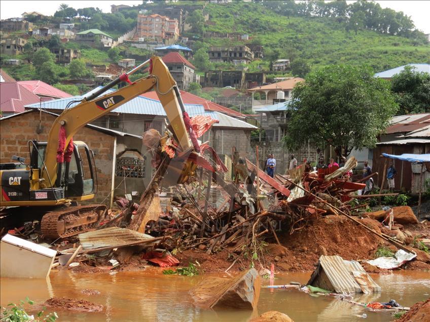
On August 14, 2017, more than 1,000 people lost their lives in a devastating twin disaster—mudslide and flood—which swept through the Sugarloaf Mountain in Sierra Leone’s capital, Freetown.
The outlook of the Sierra Leonean hills mirrors Aburi Mountains in many ways –up on the hills, multi-storey houses either have either been built or are being built on dangerously steep slopes once covered by a forest.
A World Bank report points to a multifaceted issue that caused the Freetown slide. These include heavy rainfall, the steep nature of the sloping mountain as well as human interference.
The report also observes that the area the landslide occurred was within a protected forest reserve. However, over time, the development of large houses had occurred, some illegally (without permits) and some with permits.
The Aburi Mountain has had its share of the landslide from 2010 to 2019, compelling the Roads and Transport Committee of Parliament to call for the urgent demolishing of buildings along the mountains as a solution to recurring landslides.

Their call was as a result of a landslide, which induced flooding, displacing 559 residents after four hours of rain, Graphic Online reported on October 28, 2019.
But nothing happened.
With little land planning or enforcement of building codes to guide the built environment on the mountain, Mr. Opoku says the rate at which buildings are springing up on the mountain, “is increasing the risk each day as we keep developing those areas.”
He says as real estate developers prepare the foundation for buildings, they cut sections of the mountains and over-steepen the slope, which increases the risk of landslides.
“They are also removing the vegetative cover which helps check the landside. The development is endangering the place and making it prone to landslide,” he adds
Although the newly passed Geological Survey Act 2016 (Act 928) requires that site investigations be carried out before any construction work is done, the law is restricted to only major state projects.
Mr. Opoku says none of the buildings on the Aburi Mountain have had their site assessment done because the buildings would have to be of a particular height before a developer is required to do a site assessment.
“In a landslide-prone area, you don’t need to put a massive building because there can be a failure of the foundation,” he adds.
Asked if the authority has projections on when such a disaster might happen, Mr. Opoku is of the expert view that “geohazards are very difficult to predict but the activities will let us know whether we are increasing the risk of having it.”
He also indicates that it is too late to reduce the risk in the heavily built areas but is quick to add that future developments should be controlled.
Ghana’s earthquake red flags were recently raised when it came out that key national assets, including the Jubilee House, Kotoka International Airport, Tema Harbor, the Akosombo dam, and others, are at risk of collapsing if an earthquake occurs.
A committee set up by the government to assess Ghana’s disaster preparedness earmarked the earthquake-prone zones in a report. President Nana Akufo-Addo issued a call to action to the stakeholders in the emergency preparedness space.
Ghana’s earthquake and landslide history
Ghana has had earthquakes dating back to more than 200 years, according to a document titled the “Gold Coast Geological Survey Bulletin 13”. The significant ones were in 1862, 1906 and 1939 with smaller ones in 1858, 1863, 1883, 1907, 1911, 1918-19,1923,1925,1930 and 1933-1935 and 1939.
The country also has a long history of landslides dating as far back as 1933. These include:
March 5, 2005
The entire Afram Plains District and part of the Kwahu South District were cut off from the rest of the country as a result of a landslide at Kam, a village near Pitiku Junction in the Eastern Region, after a heavy downpour.
The first landslide in the area occurred in 1972.
June 20, 2010
A heavy downpour triggered a landslide on the Peduase-Water Works road, a stretch of the Ayi-Mensah-Aburi dual carriageway in the Eastern Region.
The landslide occurred close to a two-storey building on the edge of the rocky mountain, blocking part of the road.
October 6, 2010
A landslide that occurred during a heavy downpour at Adukrom-Yensi in the Eastern Region killed three people and destroyed many properties.
October 25, 2012
Twenty acres of cocoa farm was destroyed at Wassa Asikuma and Wassa Nkran in the Prestea Huni/Valley District in the Western Region following heavy rainfall. It affected 60 cocoa farmers.
June 2013
Loose parts of the mountain fell and blocked the Kasoa-Weija portion of the road after a heavy downpour, resulting in a traffic jam for hours.
October 18, 2019
After nearly an hour of heavy rains, some rock particles and debris eroded from the Aburi mountain and landed on the highway blocking a part of the road.
EDITOR’S NOTE: This story shall not be republished or broadcast, in part or in full, in any form or shape without the express permission of the Editor-in-Chief.
You can reach the writers via email at [email protected]/[email protected], or on Twitter @thekekeli

Well written. Thanks yoi very much.
You guys are making journalism look attractive again. I enjoyed reading this.
Well research write up
This is deep ,good journalism.
A timely warning. But do the powers that be have the political will to implement the appropriate measures? And wld the citizens especially those who wld be affected accept their loses and start life afresh elsewhere?
Only time wld tell.
Well!!! Let wait till it happens for big grammar to be spoken
Very good piece. I enjoyed reading it. I have no doubt that with my brother, Manasseh and the rest this news portal will grow to be like the BBC, the CNN.
Thanks for sharing with us ??
impressive and life saving analysis
Great piece.
We, as concerned citizens should create more awareness about perfectly balancing developing our own country into beautiful safe neighbourhoods and working within mother nature.
Can this piece of story also be put on TV, other mediums, so as to shine the spot light on those who are now building or about to build.
Superb writing. Just stay the course!!!
I hope the appropriate authorities tackles this issue before it will be too late. It ought to be treated urgent.
Wow! Very exhaustive. Captured every detail needed. Well done. If only authorities will act as expected. You have done your part. May Allah bless you ??
Great write-up
Great work done
Good write up. Unfortunately those in charge are not doing anything. There’s a Rehoboth estate coming up on the mountain from the Ayi Mensah side of it. At the moment the whole mountain has been cleared for development to begin. It’s going to eat into the inbound Ayi Mensah Peduase side of the road. Which can lead to it’s collapse. We are bent on destroying everything in our path. The authorities in charge should wake up and do the needful before the whole mountain comes collapsing down.
Journalism at it’s peak.
Great report but slightly concern about this; “The aerial photographs, transmitted by The Fourth Estates’ drone hovering above the mason and his fellow workers, show a grand edifice that looks more like a resort than a residential facility”. Isn’t it privacy invasion? Couldn’t it have been rewritten in avoidance of exposure? Thank you for this lovely well-informed piece.